1-D numerical models of post-glacial river evolution
Jon Tunnicliffe, School of Environment
Simulating river evolution
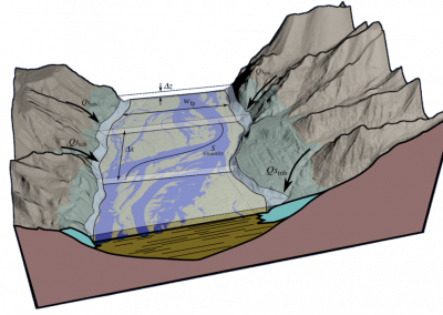
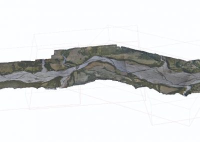
Since the close of the last glacial maximum, many mountain valley river systems with large glacial fills have undergone complex rearrangement of channel morphology, sedimentology, and long profile due to changing sediment supply conditions and fall in base-level. Our research has focused on the question of whether we can apply model representations of sediment transport processes – derived at the annual to decadal scale – to large valley systems at the millennial scale. It would appear that many aspects of the process of erosion of these valleys fills, and the enduring influence of this glacial legacy on the modern river, can be captured quite well (see Figure 1).
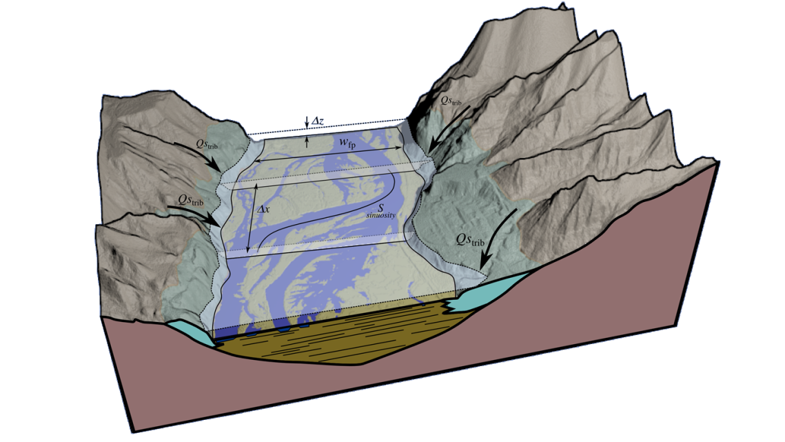
Figure 1: Model discretization of the post-glacial valley floor. We employ a 1-dimensional finite-volume framework that encompasses the river-floodplain system and contributions from tributary sources, to simulate down-cutting and evacuation of Pleistocene glacial sediments.
The need for Pan
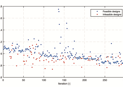
Establishing model uncertainties, and the relative importance of each transport model parameter, is a highly complex and non-linear problem. By running a considerable number of parallel instances of the model, we are better able to assess the many contingencies and interactions amongst all of the model variables. For instance, a heightened proportion of boulders in the original valley fill results in a much deeper concavity of the river profile (thus an improved match with the modern river), while higher assumed rates of gravel abrasion will act to suppress concavity but promote more prominent downstream diminution in median grain size. We have also gained insights into how multiple tests of fitness for model results (e.g., proportion of sand in the river bed or the rate of grain size diminution downstream) cannot all be satisfied at once, highlighting some important areas for future model refinement. Typical model run times are more than one day; having access to a large number of cores makes it feasible to achieve what is an otherwise impossible task. We are able to comprehensively assess the dynamic behaviour of mophodynamic models in ways that we previously could not (see Figure 3).
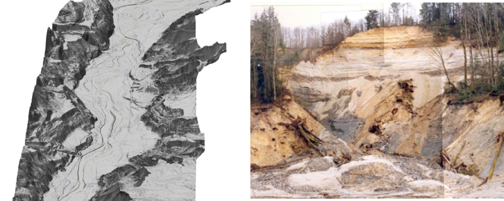
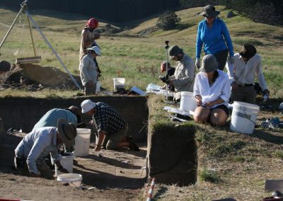
Figure 2: A river inset within deep (>100m) relict glacial fill. As the river eroded through these layers, it recruited material from the substrate, progressively concentrating the proportion of coarser, bouldery material.
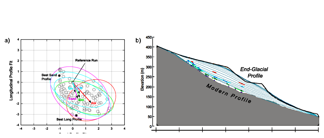
Figure 3: (a) Model results: multiple model runs provide an indication of the relative influence of governing variables. (b) The trajectory of model river downcutting is compared with measurements and dating of various terrace levels in the modern system.
Future work
We are in the process of completing our model runs; our intention is to further explore how climate and vegetation changes throughout the Holocene may have altered the pace of morphologic development of the river system. Results from parameter sensitivity work will feed back into further model refinement. The power of the grid could also be used to explore a number of random forcings on the valley-floor system, such as mass movements and debris flows, which have influenced the river system over time. More powerful 2-dimensional models could also be put to the task of exploring the long-term evolution of post-glacial mountain river systems.
See more case study projects
Fully coupled thermo-hydro-mechanical modelling of permeability enhancement by the finite element method
Modelling dual reflux pressure swing adsorption (DR-PSA) units for gas separation in natural gas processing
Molecular phylogenetics uses genetic data to reconstruct the evolutionary history of individuals, populations or species

Wandering around the molecular landscape: embracing virtual reality as a research showcasing outreach and teaching tool


