Building a discrete global grid gazetteer service
Dr Benjamin Adams, Research Fellow, Department of Computer Science and Centre for eResearch, University of Auckland
Discrete global grid gazetteer service
A geodesic discrete global grid is a partitioning of the surface of the globe into a grid of equal area cells. An indexed hierarchy of grids at multiple interrelated levels of resolution is called a discrete global grid system (DGGS). Digital Earth systems use DGGSs as a spatial framework for data interoperability, to organise heterogeneous spatial information in a way that is robust for statistical inference.
To date, most of the prominent research applications of discrete global grids relate to land cover, remote sensing, and other geoscience investigations, but it is difficult to integrate more socially-derived place-based data into a DGGS. This is because, previously, there has not existed an easy way to map between the named places on the Earth to the grid cells of a DGGS.
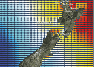
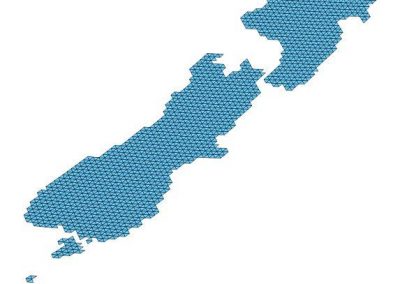
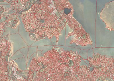
This project is an effort to fill this gap by creating a discrete global grid gazetteer service that provides such a mapping between 11 million named places from the online Geonames database to a set of different DGG systems (see Figure 1). In addition to creating a new gazetteer database, the information has been published as Linked Data in GeoJSON-LD format (see Figure 2), which enables it to be easily combined with other data sources that make up the Open Linked Geodata Web.
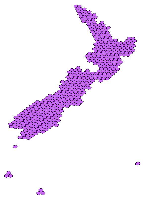
Figure 1. This shows the output from the gazetteer service of the grid cells that correspond to New Zealand using two sample projections and granularity levels.
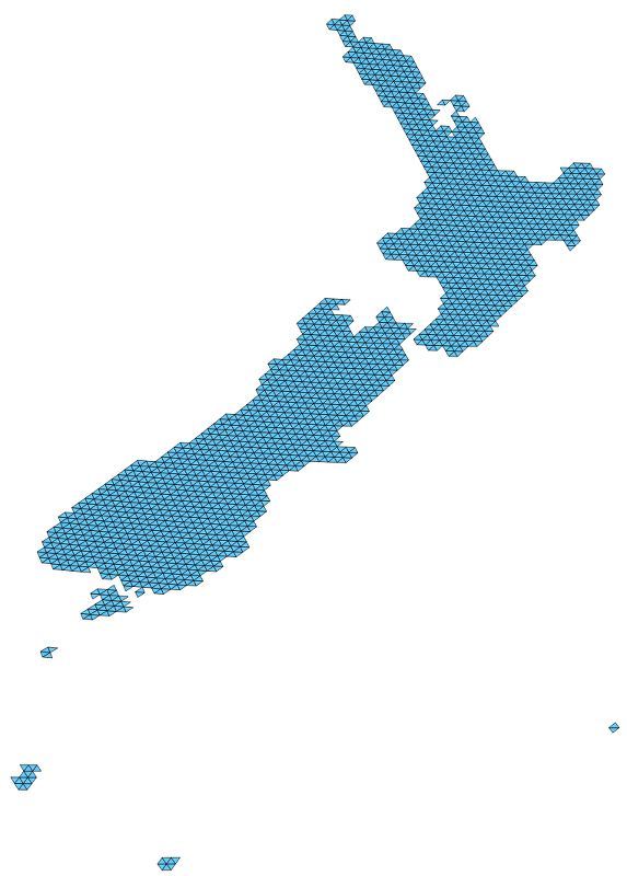
1a left: Icosahedral Snyder Equal Area aperture 3 hexagon level 10, Figure 1b right: Icosahedral Snyder Equal Area aperture 4 triangle level 9.
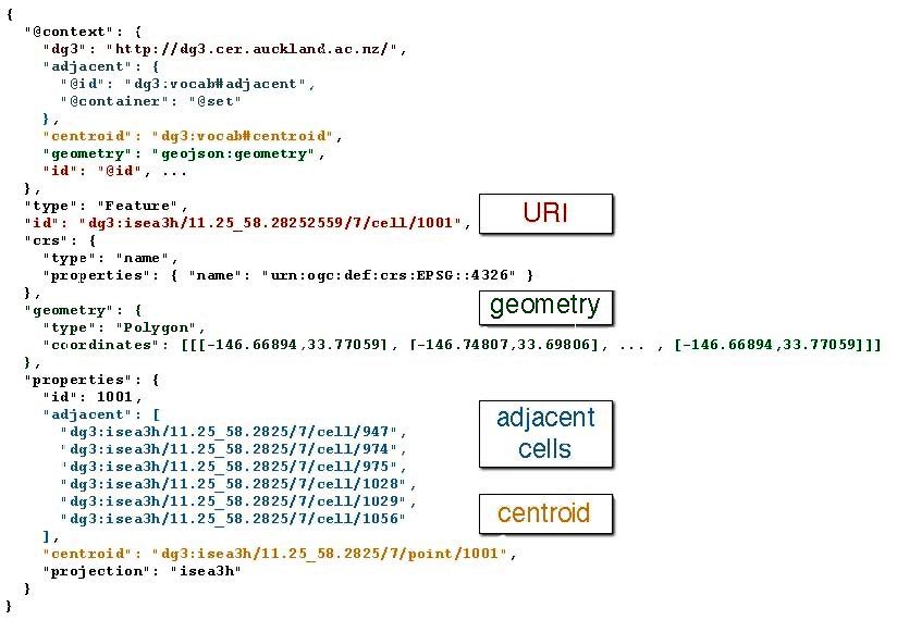
Figure 2: sample encoding of a grid cell geometry as Linked Data using GeoJSON-LD format.
Using a research VM to develop and host the service
The Research VM provided essential compute and data storage needs to create the gazetteer database, as well as to build and host the services that allow users to access the data for a variety of purposes. One of the key elements of Linked Data is that every resource has a unique identifier (URI) that is resolvable, which means if you follow the URI as a link on the web, then it should lead you to the data you are looking for. It is important therefore that the server hosting the data persists and remains available for users once it has been published, so that others can use the URI to link to other data sets and publications. The research VM hosts all the data online from the http://dg3.cer.auckland.ac.nz URL. The discrete global grid gazetteer project will be ongoing as additional sources of data are added to the database and new kinds of grid systems are included.
Reference
Publication: Benjamin Adams (2016) Wāhi, a discrete global grid gazetteer built using linked open data.
See more case study projects
Fully coupled thermo-hydro-mechanical modelling of permeability enhancement by the finite element method

Modelling dual reflux pressure swing adsorption (DR-PSA) units for gas separation in natural gas processing
Molecular phylogenetics uses genetic data to reconstruct the evolutionary history of individuals, populations or species

Wandering around the molecular landscape: embracing virtual reality as a research showcasing outreach and teaching tool


