Developing virtual capabilities for the Science Payload Operations Centre
Adjunct Prof. Delwyn Moller, Department of Electrical, Computer, and Software Engineering ; Dr Mike Laverick, Dr Chris Seal, Yvette Wharton, Centre for eResearch

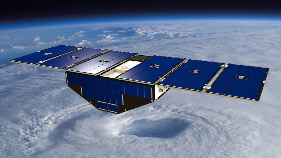
In orbit, the CYGNSS mission has eight small satellites flying in formation. They collect GPS signals that reflect off Earth’s surface, which scientists use to infer windspeed over oceans and soil moisture measurements over land.
Credits: University of Michigan
The Space Payload Operations Centre (SPOC)
A new Science Payload Operations Centre (SPOC) is actively under development at the University of Auckland and the Centre for eResearch, with the aims of more-closely integrating payload operations and science pipelines, and bringing together both payload engineers and the end-user scientists of the payload data.
The SPOC will communicate with and control terrestrial, airborne, and space-based remote sensors, pulling their data into the Operations Centre for further processing. Retrieved data will first be processed into L0 data products, before being passed through various scientific pipelines to produce L1, L2, and L3+ level science-ready data products. It will also facilitate the hosting and distribution of all levels of data products, including the running of visualisation suites for data produced from the various scientific pipelines and payloads.
First payload: the Next-Generation GNSS-R Receiver (NGRx)
The first payload to be hosted by the SPOC is the next-generation GNSS-R receiver, currently under development in conjunction with collaborators
at NASA, the University of Michigan, and the Ohio State University, which will be mounted on a commercial Q300 aircraft flown by Air New Zealand (press articles can be found at the end of this case study)
Global Navigation Satellite System Reflectometry (GNSS-R) provides a unique means of inferring geophysical conditions of the Earth’s surface without the need for costly, and often infeasible, in-situ climate monitoring systems. As part of NASA’s Cyclone Global Navigation Satellite System (CYGNSS) mission, and in conjunction with Air New Zealand, we are taking the novel approach of mounting a GNSS-R receiver on a commercial aircraft, that shall allow for an unprecedented collection of climate data over and around the islands of New Zealand. Such data includes inundation and coastal dynamics, and soil moisture content and variability, as demonstrated by the existing CYGNSS mission (https://www.nature.com/articles/s41598-018-27127-4),and the data that is produced will be made publicly available to researchers around the world.

Prof. Christopher Ruf, inspects one of the GYGNSS Satellites before it is deployed into orbit. Photo / Supplied, Nasa
Virtual capabilities of the SPOC: simulation and visualisation
While the building of the physical NGRx payload is underway, on track to be built and mounted during 2021, we can focus our efforts into developing the virtual capabilities of the SPOC. Leveraging the computational resources available through the Nectar research cloud, we can perform physical simulations of a Q300-mounted NGRx and produce synthetic GNNS-R data, helping us to understand the expected spatial coverage of the data over New Zealand; ranging from a single flight of a craft-mounted payload, up to years worth of data-collection from many payloads across multiple aircrafts.
Being able to synthesise the GNNS-R data allowed us to begin developing scalable data visualisation tools that can interpret and visualise large volumes of data, prior even to the deployment of the payload. As a result we have developed an interactive historical flight visualisation tool,
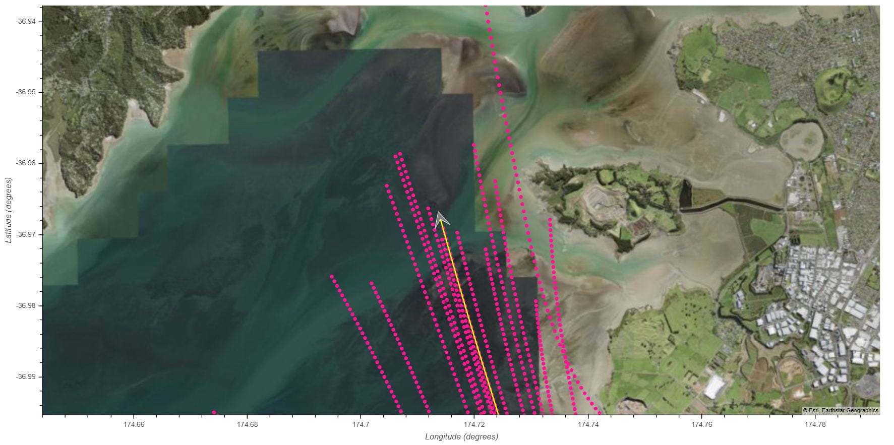
hosted via the Nectar research cloud for in-house access, that can playback a given Q300 flight and “real-time” depict the GNSS-R data as it is detected by the payload. An example of this is shown in Figure 1 below (youtube links for video playback), which is developed in Python using the Bokeh visualisation library.
The developed visualisation tool provides a useful code base from which further data exploration and diagnostic tools can be developed. We have already created a live flight-tracking tool, making use of the OpenSky Network API, which we can use to track our payload location during flight, and future plans involve using the live flight data to perform on-the-fly synthetic data calculations to predict the geospatial data coverage we expect to receive once the payload lands. We also intend to produce intuitive interactive tools to select and retrieve L0+ science data for researchers to use.

An interactive visualisation tool for “playback” of historical flights/payload data. Current visualisations make use of simulated data created by the SPOC. See https://www.youtube.com/watch?v=GbmFFjoQtr8 , https://www.youtube.com/watch?v=xcSlaXDtd8w
Press releases:
1. https://www.nasa.gov/feature/goddard/2020/nasa-new-zealand-partner-to-collect-climate-data-from-commercial-aircraft
2. https://www.mbie.govt.nz/about/news/new-zealand-joins-nasa-science-mission-to-monitor-climate-change-impacts/
3. https://www.airnewzealand.co.nz/press-release-2020-airnz-joins-nasa-climate-science-mission
4. https://www.nzherald.co.nz/travel/air-new-zealand-joins-nasa-for-special-mission/JVXFHM2LLWHSWKDTRZWEUV4D5E/
Note: NASA is partnering with the New Zealand Ministry of Business, Innovation and Employment, New Zealand Space Agency, Air New Zealand and the University of Auckland to install next-generation Global Navigation Satellite System (GNSS) reflectometry receivers on passenger aircraft to collect environmental science data over New Zealand.