Processing structure-from-motion photogrammetry on the cluster
Dr Jon Tunnicliffe, Lecturer, School of Environment
Introduction and research
The nature of earth surface processes analyses and simulation has changed dramatically in recent years, owing mainly to new capabilities in the acquisition and processing of high-resolution point cloud data. The availability of new photogrammetric “bundle adjustment” methods has had a notable impact on how we can represent and model the landscape. Using a highly overlapping sequence of photos from a ground-based or aerially-mounted camera, it is now possible to generate very accurate, high resolution topographic models. The photogrammetric technique is computationally quite demanding, and thus for relatively large study areas (thus many photos), generating point cloud models moves beyond the realm of desktop computing.
In the following work, we used a 24 MP camera mounted on an unmanned aerial vehicle (UAV) to acquire more than 5,000 photos of the braided Tapuaeroa River in East Cape New Zealand. The catchment is noted for its very high rates of sediment production through landsliding and mass wasting, resulting in highly dynamic river systems. Morphologic adjustments such as channel avulsions and bifurcation, and bar erosion occur quite frequently. The aim in developing a high resolution model of the river was twofold: (1) to provide a basis for numerical simulation of river hydrodynamics and these morphologic processes, and (2) to generate a baseline model against which we can quantitatively compare future change. The dataset will have a number of important applications in catchment management, land use planning, habitat assessment, and improved understanding of river response to long-term sedimentary disturbance.
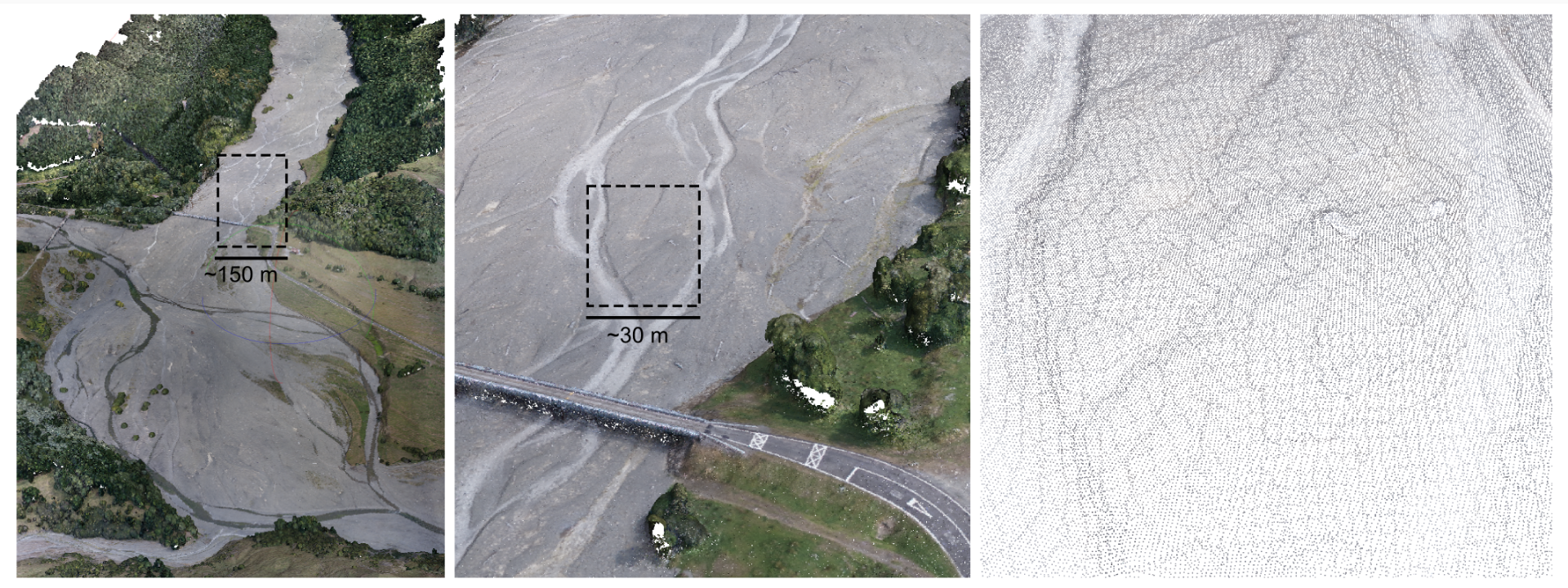
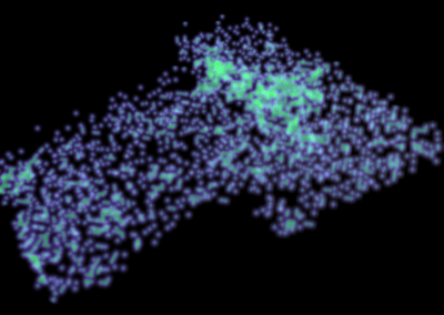
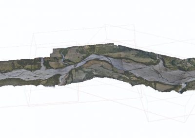
Figure 1 – An example of point cloud data on the Tapuaeroa River. The point density achieved was close to 25 pts/m2, along a 12.5 km transect of valley floor. Fine details of river morphology are resolved, such as abandoned channels and bar-top sheets of fine sediments. Even grain roughness can be resolved, in coarser sediments.
What was done on the Pan cluster and how it helped
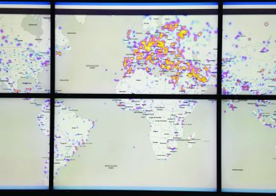
We used the NeSI Pan cluster to process our aerial photos using Agisoft Photoscan, a structure-from-motion software package that features fine-level task distribution, such that processing tasks can be passed out to hundreds of cores. The Centre for eResearch helped to develop this parallel workflow, reducing the working time for a large survey such as this from many weeks to a few days. We generated a point cloud for the full valley floor, with 30 ground-control points, and many tens of millions of topographic points. Gridding, manipulating and clipping portions of the resulting point cloud requires significant RAM resources, which, again, is not easily handled on a desktop computer. The Centre for eResearch’s visualisation facility with its large tile-wall display provided an impressive view of the point cloud in a single display frame. Once the topographic surface was subdivided into tiles, it could again be handled by desktop machines.
What’s next?
We will be flying over the Tapuaeroa River in early 2016, with the aim of developing a ‘difference map’. By subtracting the 2015 model surface from this later surface, it is possible to develop a highly detailed, quantitative picture of morphologic change in the river system. We have developed a research group with students and researchers from the University of Auckland and Massey University’s Institute of Agriculture & Environment (Ian Fuller) to leverage the full analytical potential of this technique, and expand our survey coverage. The work will be featured at the upcoming 11th International Symposium on Ecohydraulics (2016) in Melbourne. This project forms the basis of a series of papers that will be submitted to Earth Surface Processes and Landforms and Geomorphology.
Anya Leenman has been working toward completion of her MSc in Geography, with her thesis ‘Interpreting the Changing Morphology of Tributary-junction Alluvial Fans in Response to Catchment Wide Disturbance’ due to be completed by March, 2016. Anya has been able to reconstruct the decadal-scale dynamics of tributary fans in this valley, based on very high resolution models of the alluvial fans in tributaries that join the Tapuaeroa River.

Figure 2 – Merged point cloud, representing five surveys, with over 160 million data points, generated using 2,700 photos.
See more case study projects

Our Voices: using innovative techniques to collect, analyse and amplify the lived experiences of young people in Aotearoa
Painting the brain: multiplexed tissue labelling of human brain tissue to facilitate discoveries in neuroanatomy

Detecting anomalous matches in professional sports: a novel approach using advanced anomaly detection techniques

Benefits of linking routine medical records to the GUiNZ longitudinal birth cohort: Childhood injury predictors
Using a virtual machine-based machine learning algorithm to obtain comprehensive behavioural information in an in vivo Alzheimer’s disease model
Mapping livability: the “15-minute city” concept for car-dependent districts in Auckland, New Zealand
Travelling Heads – Measuring Reproducibility and Repeatability of Magnetic Resonance Imaging in Dementia
Novel Subject-Specific Method of Visualising Group Differences from Multiple DTI Metrics without Averaging

Re-assess urban spaces under COVID-19 impact: sensing Auckland social ‘hotspots’ with mobile location data
Aotearoa New Zealand’s changing coastline – Resilience to Nature’s Challenges (National Science Challenge)
Proteins under a computational microscope: designing in-silico strategies to understand and develop molecular functionalities in Life Sciences and Engineering
Coastal image classification and nalysis based on convolutional neural betworks and pattern recognition
Determinants of translation efficiency in the evolutionarily-divergent protist Trichomonas vaginalis
Measuring impact of entrepreneurship activities on students’ mindset, capabilities and entrepreneurial intentions

Using Zebra Finch data and deep learning classification to identify individual bird calls from audio recordings
Automated measurement of intracranial cerebrospinal fluid volume and outcome after endovascular thrombectomy for ischemic stroke
Using simple models to explore complex dynamics: A case study of macomona liliana (wedge-shell) and nutrient variations
Fully coupled thermo-hydro-mechanical modelling of permeability enhancement by the finite element method
Modelling dual reflux pressure swing adsorption (DR-PSA) units for gas separation in natural gas processing
Molecular phylogenetics uses genetic data to reconstruct the evolutionary history of individuals, populations or species
Wandering around the molecular landscape: embracing virtual reality as a research showcasing outreach and teaching tool


